Ocean Theory and Long Distance Sailing
 Sailing long-distance is a dream for many yacht skippers, and is – surprisingly – more attainable than you might think.
Say you are a reasonably experienced coastal/offshore skipper - you either have your own boat or are thinking of getting one. To prepare for long distance, you need to extend your theory knowledge. When you first learned to be a skipper, you learned about charts, tides and weather etc as they applied to coastal sailing in your part of the world. While all of this is still very relevant, you now need to learn about:
• long distance navigation
• world climate.
You also need to know some more practical things, such as:
• getting the yacht ready for long distance / long term sailing
• communication
• ocean passage-making.
Reeds Ocean Handbook will provide a lot of information on all of this, as well as references to more detailed information resources you may need (such as world pilot charts). It will act as a useful practical guide as you go through your preparation for a long-distace trip.
It is also a useful companion to the RYA's Yachtmaster Ocean course, if you decide to do that.
Book Overview
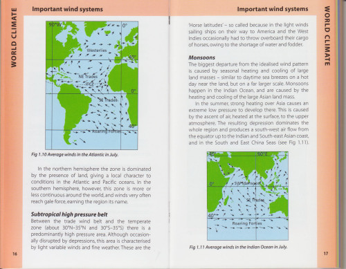
The first section is on world climate. It explains: • the wind systems in the different oceans • local winds in different parts of the world • ocean currents |
 |
|
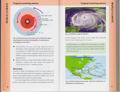
• how and where tropical revolving storms (typhoons / hurricanes / cyclones) are formed, and how to avoid them
This is the knowledge you need for route planning, i.e. where and when to sail.
|
 |
|
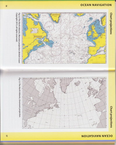
The next section explains about ocean navigation. The navigation theory you have already learned still applies. However there are other things that you need to know for ocean passages: • different chart projections that are better for showing great circle routes • magnetic variation and deviation on long passages • time zones and longitude • satellite navigation systems (GPS, GLONASS, Galileo) |
 |
|
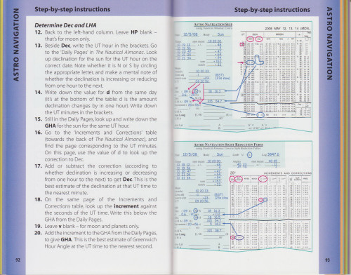
The section on astro navigation (using a sextant)takes a realistic, practical approach for navigators whose primary tool is GPS. It is wise to have astro as a 'fall-back' option for position fixing if your electronic navigation fails, but realistically, most people will rarely if ever need to use it in earnest. The book explains: • the principles of astro navigation • how to use a sextant to take sights. |
 |
|
|
• how to perform sight reduction using 'pencil and paper'. (It is assumed that if the GPS has failed, this is the surest option for a fall-back method.) • method uses the 'concise tables' contained in The Nautical Almanac (the essential reference that you need to carry for any astro navigation). No other tables are needed. • the book gives clear, step-by-step instructions, to make the process as easy as possible to follow. • the book uses its own one-page astro navigation form, which can be downloaded here. |
 |
|
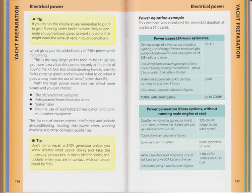
The following sections focus purely on the practical. First there is a section on preparing the yacht for long distance and long term cruising. This includes: • sails and spares, downwind rig with two headsails • self-steering • electrical power generation and usage • water making and storage • general checks, spares and tools |
 |
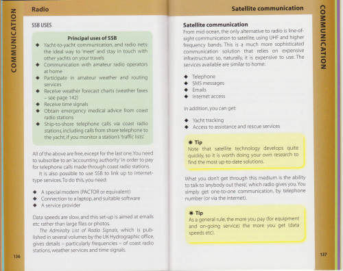
Communication gets its own section. This will help you to select from the different options, which include: • VHF radio: line-of-sight only • mobile phone: coastal access • HF SSB radio: talking to other vessels, weather fax, ship-to-shore telephone • satellite telephone: phone and basic internet • satellite broadband: top end solution |
 |
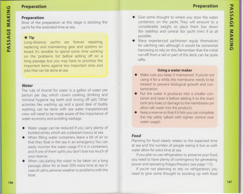
Passage making covers: • planning for an ocean passage • preparation (food, water, gas) • on-passage routine: includes navigation tasks, and crew organisation and wellbeing
Heavy weather and storm tactics are also covered, in their own section.
|
 |
|
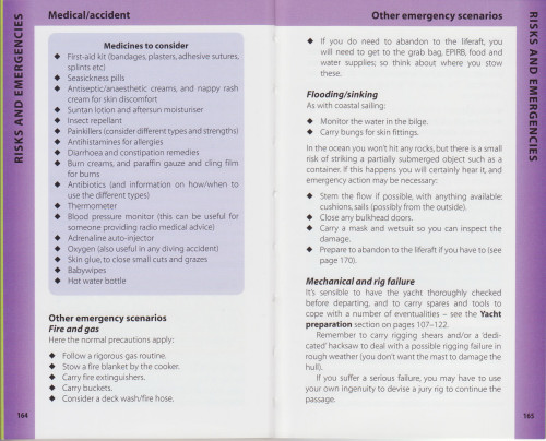
Preparation for emergencies covers: • medical/accident: prevention of accidents and medicines to carry • other emergany scenarios: fire, flooding/sinking, structural failure of yacht, man overboard • assistance and rescue • survival |
 |
To Buy This Book
You can buy this book from Adlard Coles Nautical (part of Bloomsbury), or from Amazon, or from any good bookshop or chandlery (complain if they don't have it!)
Errata
The following minor errors have been noted:
page 79, EXAMPLE box, line 5 - should read "At 32° 11'W (near the Azores) ..."
page 131, Table Overview of communication options, row 1 - should read:
Purpose |
Coastal |
Ocean |
Talking to |
• Line of sight: marine VHF radio |
|
page 133, 2nd paragraph, line 1 - should read "AIS is also VHF technology ..."